


Harris P-B, Chisago County, Minnesota
About
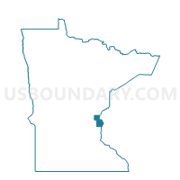
Outline

Summary
| Unique Area Identifier | 601508 |
| Name | Harris P-B |
| County | Chisago County |
| State | Minnesota |
| Area (square miles) | 3.72 |
| Land Area (square miles) | 3.71 |
| Water Area (square miles) | 0.01 |
| % of Land Area | 99.60 |
| % of Water Area | 0.40 |
| Latitude of the Internal Point | 45.57237170 |
| Longtitude of the Internal Point | -92.95344400 |
Maps


Graphs
Select a template below for downloading or customizing gragh for Harris P-B, Chisago County, Minnesota


Neighbors
Neighoring Voting District (by Name) Neighboring Voting District on the Map
- Harris P-A, Chisago County, MN
- North Branch P-N, Chisago County, MN
- Sunrise Twp. Voting District, Chisago County, MN
Top 10 Neighboring County Subdivision (by Population) Neighboring County Subdivision on the Map
- North Branch city, Chisago County, MN (10,125)
- Sunrise township, Chisago County, MN (1,994)
- Harris city, Chisago County, MN (1,132)